Mitigating soil erosion disasters
With catastrophic storms and fire events on the rise, our scientists have developed an accurate and site-specific soil erosion modelling system, helping to mitigate risks, manage emergencies and secure water quality.
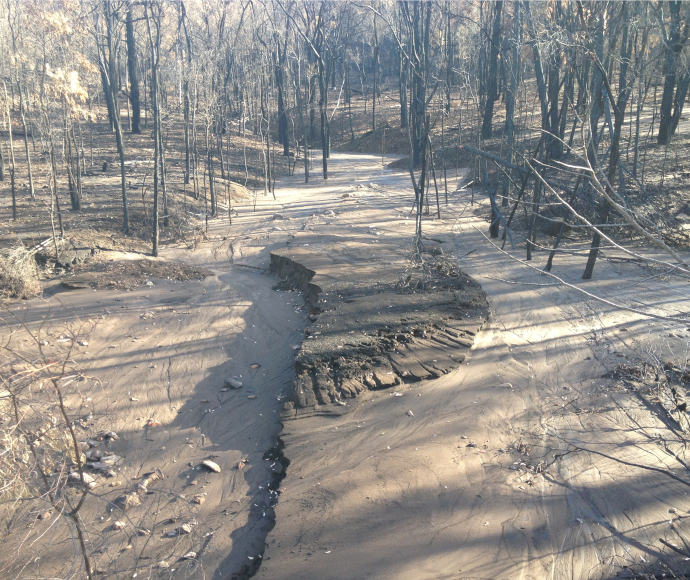
In some areas of New South Wales, such as the Sydney water catchment, soils have been eroding at more than 10 times the normal rate after fires and storm events in recent years. These erosion rates are predicted to continue increasing in the future. Soil erosion impacts air quality if the soil becomes airborne, leads to agricultural losses as nutrients are stripped away from the land surface, and can cause poor water quality when sedimentation causes algal blooms.
The challenge
Until recently, most soil erosion modelling was based on a system developed in the United States of America 50 years ago for agricultural plots. This system is unsuitable for Australian forest conditions and doesn’t take into account impacts of climate change such as more intense storm, drought and fire events, or variations in seasons and regions.
Relying on this old and imported modelling meant that those who need to keep track of soil erosion, such as conservation and land managers, water authorities and emergency workers, weren’t able to properly identify, manage and mitigate many of the risks that soil erosion creates.
Our response
Ten years ago, Dr Xihua Yang, Principal Scientist in the Science, Economics, and Insights Division of the Department of Climate Change, Energy, the Environment and Water, began working on a new, more precise soil erosion model that takes into account local circumstances and changing conditions due to climate change. The model has been recalibrated and refined over time and is now used by a range of government departments.
Dr Yang said the previous models didn’t factor in the short, intense rainfall events that cause soil loss. ‘For soil erosion calculations, rainfall intensity is probably more important than total rainfall,’ he said. ‘This new model uses a weather forecasting radar, with data updated every 5 or 10 minutes, to calculate rainfall. It’s never been used for soil erosion modelling before.’
The impact
From the north coast of New South Wales to western New South Wales and the Sydney catchment, a variety of agencies are now using the new model, including the NSW Environment Protection Authority, NSW Rural Fire Service and Local Land Services. It helps assess and mitigate safety risks to personnel and infrastructure, but Dr Yang says it also helps scientists understand nutrient transfer and loss caused by erosion, which is estimated to cost $4.2 billion a year in New South Wales alone.
‘Movement of sediments causes a lot of other environmental problems,’ Dr Yang said. ‘It isn’t just soil – it’s a higher content of nutrients such as carbon, nitrates and phosphorous, so I changed my model to calculate how much nutrient loss was transported to the water.’
After the catastrophic Black Summer bushfires of 2019–20, WaterNSW began working with Dr Yang and the department to use the new models to identify and prioritise areas most at risk of severe erosion. WaterNSW was able to assess bushfire impacts on water quality across the Sydney Drinking Water Catchment.
‘With Dr Yang’s collaboration we are better able to prepare for future events,’ said Dr Quinn Ollivier, Water Quality Scientist with WaterNSW. ‘Ideally we highlight areas with a high probability of erosion before a fire and prioritise mitigation in those areas.’
Next steps
WaterNSW is working with Dr Yang to quantify how erosion affects water quality. Using sediment traps and a variety of experiments over the next 2 to 3 years, they will collaboratively add detail and verify the new soil erosion model. This will give water treatment agencies an advantage in combating sedimentation due to erosion.
Dr Yang is also collaborating with the Federal Government and CSIRO to have the model used nationwide in regional programs such as Landcare Australia.
