Hazard reduction burns for Murrah Flora Reserves
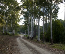
The NSW National Parks and Wildlife Service (NPWS) is planning a hazard reduction burn in Murrah Flora Reserves off Tee Ridge Road and Lizard Road from Thursday 2 May, weather permitting.
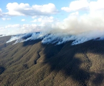
The hazard reduction burns intend to treat approximately 280 hectares of bushland located 13 km north-east of Bega within the Murrah Flora Reserves.
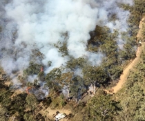
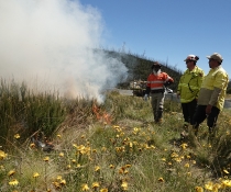
The planned burns will help to improve protection for rural properties and the nearby Wapengo and Tanja communities in the event of future bushfires. Planned low-intensity burns also aim to improve the park’s biodiversity and provide safer access for firefighters.
Lizard Road and the western end of Tee Ridge Road will be closed for the duration of the burn. Road signage will be in place.
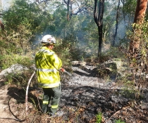
For their safety, the public should not enter this area while the operation is underway. Roads and trails will be reopened once the area is assessed as safe. Visitors must check NPWS Alerts for up-to-date information on closures.
Smoke may be visible to visitors in other areas of the national park and from surrounding areas, including Wapengo and Tanja. Motorists should use caution when driving on the Tathra Bermagui Rod and Mumbulla Creek Road.
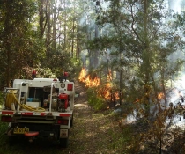
NPWS continues to patrol the recent hazard reduction burns at Mount Peter and Reedy Swamp in Mimosa Rocks National Park and Evelyn Reid in Deua National Park.
People with known health conditions can sign up to receive air-quality reports, forecasts and alerts via email or SMS from the Department of Climate Change, Energy, the Environment and Water. For health information relating to smoke from bushfires and hazard reduction burns, visit NSW Health or Asthma Australia.
More information on hazard reduction activities is available at NSW Rural Fire Service and the NSW Government's Hazards Near Me website and app.